1939 to 1950 moved around a lot, due to war, evacuations etc.
1951 to 1955 studied to become a motor mechanic in Hamburg
1956 to 1958 Sailor on a Norwegian freighter „John Bakke“
1958 Driver in the US Army in Frankfurt/Main
1959 Salesman, including door-to-door sales, in Frankfurt/Main and Hamburg. As an almost daily visitor to the Palette pub on Hamburg’s ABC-Straße, I became a Sartre follower and existentialist for the sake of my studies, sleeping in the waiting room of Hamburg’s main train station and on parked federal railway trains south of it.
1960 to 1961 owner of a Jazz-Club and a Restaurant in Hamburg
1962 Film Editor
1963 Detective
1964 to 2002 Opened and ran a car repair garage in Hamburg
1964 Married to Reni
1964 Daughter Nadine is born
1967 Daughter Susanne is born
1972 Motor mechanic master exams
1973 to 1993 Hobby pilot (various planes)
1979 to 1997 Canada- and Alaska-Adventurer (triple crossing of Chilkoot Pass, and several 1000 paddel miles in a 17 foot Canadian, mostly with Bruno Benischek from Austria)
1989 Guide for ZDF German Television (Dieter Kronzucker: „Abenteuer u. Legenden“) in Alaska and in the Yukon Territory
1990 to 2002 volunteer Examiner with the Motor Vehicle Guild in Hamburg
1979 to 1997 independant travel documentary and hobby film maker
1998 Sports boat captains license, inland
2002 Sports boat captains license, sea waterways
2002 Sale of garage and subsequent retirement
2002 Captain of a museum ship (Built 1930, 39 seats) in Hamburg/Oevelgönne
2002 til today: various inland journeys with this ship (Elbe, Hamburg – Dresden – Hamburg, various trips in the Mecklenburg Lake District, Hamburg – Berlin,
Upper- and Lower Elbe tours, Kiel Canal, from Eider to Tönning, occasional Charter trips)
Since 2003 Senior Foto Model (Best-Ager) for Television spots and Print
December 2019 Purchase of a 4k camera drone DJI Mavic 2 Zoom
January 2021 European remote pilot licence A1/A3 (drone)
February 2026 at 90 still travelling by van, port launch, bike and camera
About Dr. Bruno Benischek
1942 born in Gmünd/ Lower Austria
Grew up in the Czech border region in a custom house in Schlag near Litschau
1949-1952 Elementary school in Schlag
1952-1955 Grammar school in Zwettel/Austria
1955-1960 Grammar school in Horn/Austria and passed the school leaving examination
1960-1961 Served in the Austrian Federal Armed Forces including weapons training and a promotion to Lieutenant
1961-1969 Studied medicine at The Unversity of Vienna
1969 Passed as Doctor of Medicine
1969-1970 Doctor on routine at the Gmünd hospital in Austria
Subsequently assistant in the private Surgical Clinic of Ahrensburg near Hamburg
1977 Assistant Doctor and subsequently a surgical specialist in The Hamburg General Hospital in Wandsbeck
1977 first trip to Canada (Yukon: Whitehorse to Dawson)
1977-1982 Studied to become an Orthopaedic Surgeon at the Orthopaedic Clinic at Castle Werneck in Würzburg (during these years there were many canoe tours in the Yukon Territory and Alaska)
1982-1983 Senior Physician at the Surgical Clinic in Ahrensburg
Since 1983 first Assistant Medical Director and then Senoir Physician of the Surgical Department of the Hospital in Scheibbs/Lower Austria
In the mean time, 14x in Canada – Yukon, Northwest-Territories and Alaska with over 7000 Miles in a canoe on various rivers – many with Danny Hildebrand from Hamburg
Further Hobbies: Hunting, Hiking, Golf, in the years before a private pilot in a few classes including Glider and light planes – Licenses are not currently valid: still travelling in Canada!!
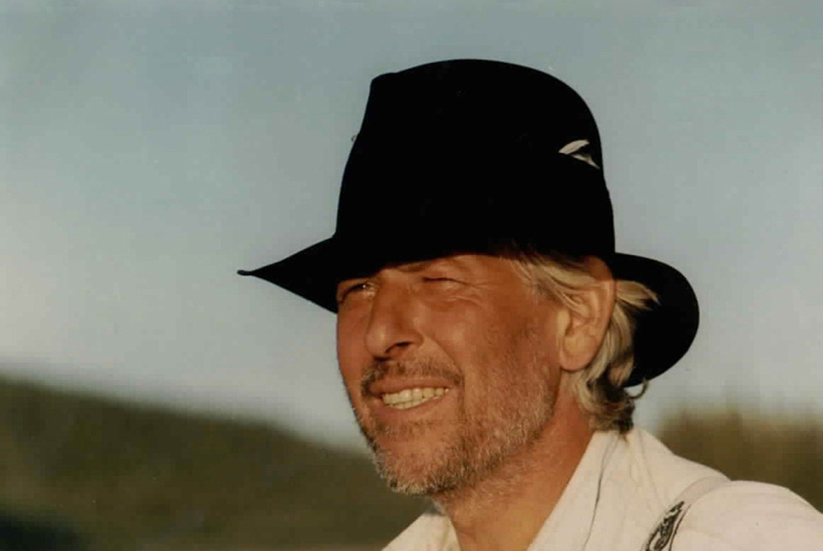
Modeling at the age of 76 It would be interesting to know what Heidi Klum had to say about Friedrich Hildebrand if he auditioned on Germanys Next Top Model. But who knows? Or cares? Friedrich Hildebrand isn’t in need to fight his way up into the modeling industry. He is right in the middle of this business already, being very successful on top of it. At the age of 76 and against all odds, cause he never even lifted a finger to become a model.
One might almost say that Friedrich Hildebrand’s modeling career was somewhat against his own will. At least in the beginning, back in 2003, it was. He was 67, had just sold his car repair shop and ready to begin life as a pensioner, when something occurred that usually rather happens to younger people now and then. Him and his wife were getting out of his car in front of a garden pub, as a woman approached them and asked him straight forward, if he wanted to start modeling. Hildebrand hesitated. “Actually, I’d rather not”, he answered. Back in his mid-thirties, he’d been in front of a camera once before. “I didn’t really enjoy it.” He took her business card anyway, but shortly after that he travelled to USA for three months and so the whole incident fizzled out. It was his wife that later reminded him of the run-in with the agent. “Come on. Go and give it a try”, she said. And Hildebrand? Well, he gave in and went to visit the agency.
Elderly persons as target groups in advertisement 9 years have pasted since then. 9 years that Hildebrand is working as a model after all. He is 76 years today and not only active for just one modeling agency anymore, but several. He is being booked for photo shootings and film productions in Germany and abroad, doing advertisement for automobiles and insurance companies, pharmaceuticals and financial institutions. He also poses for food manufacturers and traveling agencies. His wife, meanwhile just as enthusiastic in front of the camera, often joins him. What is it, that the advertisers want him and none of the 20-somethings? “Well, supposedly it is the older people that have all the money”, Hildebrand responds laughing, “so naturally that makes us the target group.”
“We aren’t all that smug!” Hildebrand is the face of many products and services, so it isn’t surprising that he is nearly ever-present on advertisement banners, TV or the Internet. He says he enjoys when he finds himself here and there, but it is always accompanied by the questions: “How long is this going to last? How long until we aren’t attractive enough anymore?”
Is he proud about his popularity? “Not really”, he answers, “we aren’t all that smug.” And being popular is relative anyway. “Sometimes, yes, I notice people on the street staring at me, puzzled, wondering where they have seen me before?” Hardly anyone would recognize him though. Probably no one would know him by name.
The burden is acceptable On an average of two times a month Friedrich Hildebrand is called to a new job. Usually it is for one day only. When his appointments take place in foreign countries – like recently, when he was shooting in turkey for a travelling agency – it will be more than that. After being done negotiating a fee with the agency, taking care of the travel arrangements and all other formalities, he is on his way. He often brings his own clothing. “It isn’t a given that there are stylists on site that provide the outfits”, he says, “but I’ve gained enough experience over the years to pretty much know what they want.”
Some shootings are wrapped up quick while others take longer. Hildebrand talks about photo sessions that took more than 8 hours, where it had to be done by hook or by crook and they worked until late in the evening. Isn’t that a bit much for a 76-year old? Sure, answers Hildebrand, and if that happens on days that include travelling then it very well is stressful. But all in all he doesn’t see it as a burden. It might have to do with the fact that photo shootings or film productions don’t require his constant presence in front of the camera. Hildebrand: “Most of this time is being used on setting up the scene.”
Waiting is part of the business How long exactly this waiting can take, is something a lay can’t even begin to imagine. Hildebrand has an anecdote up his sleeve: A photo shooting on Mallorca at a little manor in the country. Him and his wife are being picked up at 6 a.m. that morning to meet with the make-up artist, before they continue to the location where they arrive at 8 o’clock. Everything is ready for the shooting to begin. The only problem: the photographer doesn’t like the couch the couple is supposed to sit on and smile into the camera. So him and his team drive all the way to the islands capital Palma, spending a horrendous amount of money on a brand new, pearly-white sofa. At 4 p.m., eight hours later, the shooting finally begins. The visible part of the couch in the final pictures isn’t larger than a hand’s breadth…
Ain’t no sunshine everywhere True! Waiting is bearable sitting in the warmth of the Spanish sun. But just like the weather, the advertising industry isn’t consistent either. Less sunny, according to Friedrich Hildebrand, is it for example when the atmosphere on the set is somewhat ‘artificial’. More than once he experienced how everything fell apart right after a shooting was finished. No one cared about one another. Their minds were already busy with the next job.”
He is also critical about the industries drop-down of prices and some offers he won’t even accept anymore. Though money is not the only reason. “I wouldn’t want to advertise for dentures or anything that required swimwear. Those kind of inquiries I reject”, he says and adds, that he wouldn’t pose for extreme political parties either.
No end of career in sight Altogether Hildebrand enjoys his days as a senior model and is more than happy with it. He considers his activities as work, but the pleasant type. And other than the mentioned exceptions, the atmosphere at the sets is usually very nice. Extremely good are his memories about the making off an advertising movie promoting the Schleswig-Holstein Baltic Sea as a vacation region. “That was an outstanding shoot”, the residing Hamburger raves about it. “The entire team was extremely nice and the atmosphere lasted all the way to the end. We even met again afterwards.”
So he won’t disappear from advertisement and it is easy to comprehend why. It still leaves us with the question how long he will continue modeling. Hildebrand laughs as he answers: “As long as I can walk.”
Orientation for more advanced and well trained adventurers (Explore The Backcountry)
Orientation guide for trained people who want to walk through the absolutely untouched bush and without the help of a helicopter to the nameless spring waters of the upper Whitestone River/Yukon Territory to finally reach the Bering Sea via the Porcupine and Yukon Rivers (not suitable for everyone).
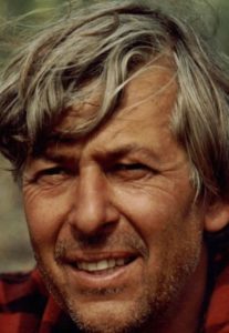
Danny Hildebrand
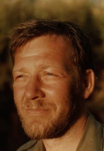
Dr. Bruno Benischek
by Danny Hildebrand and Dr. Bruno Benischek | Translation Hap Woodson
The Whitestone River and the Upper Porcupine River are ideal to those who are relatively experienced in paddling; ideal to those who look for the totally untouched wilderness on the one hand and who are physically able to cope with the strains of hiking alone through the bush to the sources of the Whitestone on the other hand; that is to those who are willing to undertake such a trip of eight days under the before mentioned conditions.
What is extremely dangerous with this tour is the fact that you are totally alone in the untouched wilderness without any possibility of calling for or getting help (today it is possible to take a PLB with you). Hence, for safety’s sake, this tour is recommended to be undertaken by at least four persons and dissuaded for learners. The experienced wanderer and canoeist, on the other hand, will meet with numerous unforgettable adventures as well as the satisfaction of having done something extraordinary, always providing that he planned the tour thoroughly before. He will be rewarded by clear and fast water without proper rapids, untouched nature with a variety of wild animals as well as fine weather during most of the tour. A crew of to men (us in 1985) in a 16 foot long canoe needed 33 days to get from Dempster Highway to Old Crow, but we were not under any pressure of time. The crew could have been in Old Crow 8 to 10 days earlier, yet, four weeks at the least are recommended when undertaking a tour of this kind.
River Classification: Grade 1-2 (no rapids)
Best time to travel: June to August
Nearest emergency communication: Dempster Highway, Old Crow (PLB)
Length: 12 km portage, 600 km waterway (50 km to Whitestone River, 120 km on Whitestone River down to the mouth of Miner River, 200 km from Miner River to Bell River, 200 km from Bell River to Old Crow).
Width: 5 to 250 meters
Time to allow: 25 days from Dempster Highway to Old Crow
Maps 1: N.T.S. 1: 250 000
Ogilvie River
Hart River
Porcupine River
Eagle River
Bell River
Old Crow
Maps 2: 1: 50.000 (Portage from Dempster to Whitestone)
116 G/9
116 G/16
116 H/12
116 H/13
Hazards: Remote wilderness, very difficult, long and arduous portage, long journey on the Rivers, swift water in many bends, logjams, sweepers, sandbars and boulders.
Directions: Via Dempster Highway, 56 km past Ogilvie Bridge
Recommended Stages
The starting point of the tour on the Dempster Highway can easily be found, it is about 56 km north of the Ogilvie Bridge. The Ogilvie River, which basically runs along the Highway to about 50 km past the Ogilvie Bridge, leaves the highway at that point and turns to the right (east). This is 7 km past an airfield on the right side of the Dempster Highway which is well marked and thus can’t be overlooked.
On the point where the Ogilvie River turns to the east the Dempster Highway begins to rise to the mountains. This point is easy to find because a creek which always has running water flows into the Ogilvie River there and is thus crossed under the highway. Then you must go on till you have reached the highest point of the highway, above the timber-line, where there is a deposit for the road gravel run by the road surveyors. This deposit is at about 100 m to the left of the highway and a gravel pass leads to it. This is exactly the starting point of the tour (see photo below). To its left is the ridge or flat peak when looking NNW (Dempster Highway behind you). Four valleys stretch out in front of you then; the one in your line of sight and to the right of the starting point, being 4 km long. The second one borders on the first, extends at right angles to it in NNE direction and is again 4 km long. The third valley runs parallel to the first, is 3 km long and again borders at right angles to a valley parallel to the second one. The latter contains the first navigable creek where as the creeks of the three valleys mentioned before are too small and don´t have enough water to be navigated in summer.
The portage to the first navigable creek is therefore at about 12 km long, which means a footpath of 60 km because carrying all the proper equipment makes it necessary to walk the route five times. This march should – if possible – lead people along the creeks and valleys because it is important that water is available for the whole time. A well-trained group is able to do the route in 4 days.
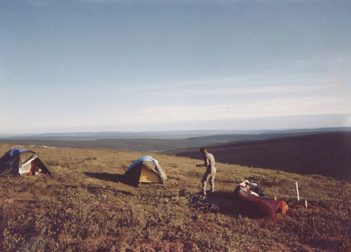
The start of the journey on the water divide
1st stage
The first kilometer of the tour can easily be covered with no obstacles or trees standing in your way. Then you have to cross quite a steep slope overgrown with trees and bushes to reach the valley to the right. The best thing is to go as far as the creek and then along the creek as far as possible. After three kilometres there is a relatively open area to the left of the creek, which is only covered with moss and grass. You can’t miss this open area because it can clearly be recognized as such from the starting point of the tour. If you want to avoid camping in the woods, this is the only acceptable camping-place although the ground is relatively moist and contains numerous deep holes with so called „niggerheads“ in between. Yet, there is a flat place for 2 or 3 tents, the creek is not far away and provides you with good drinking water.
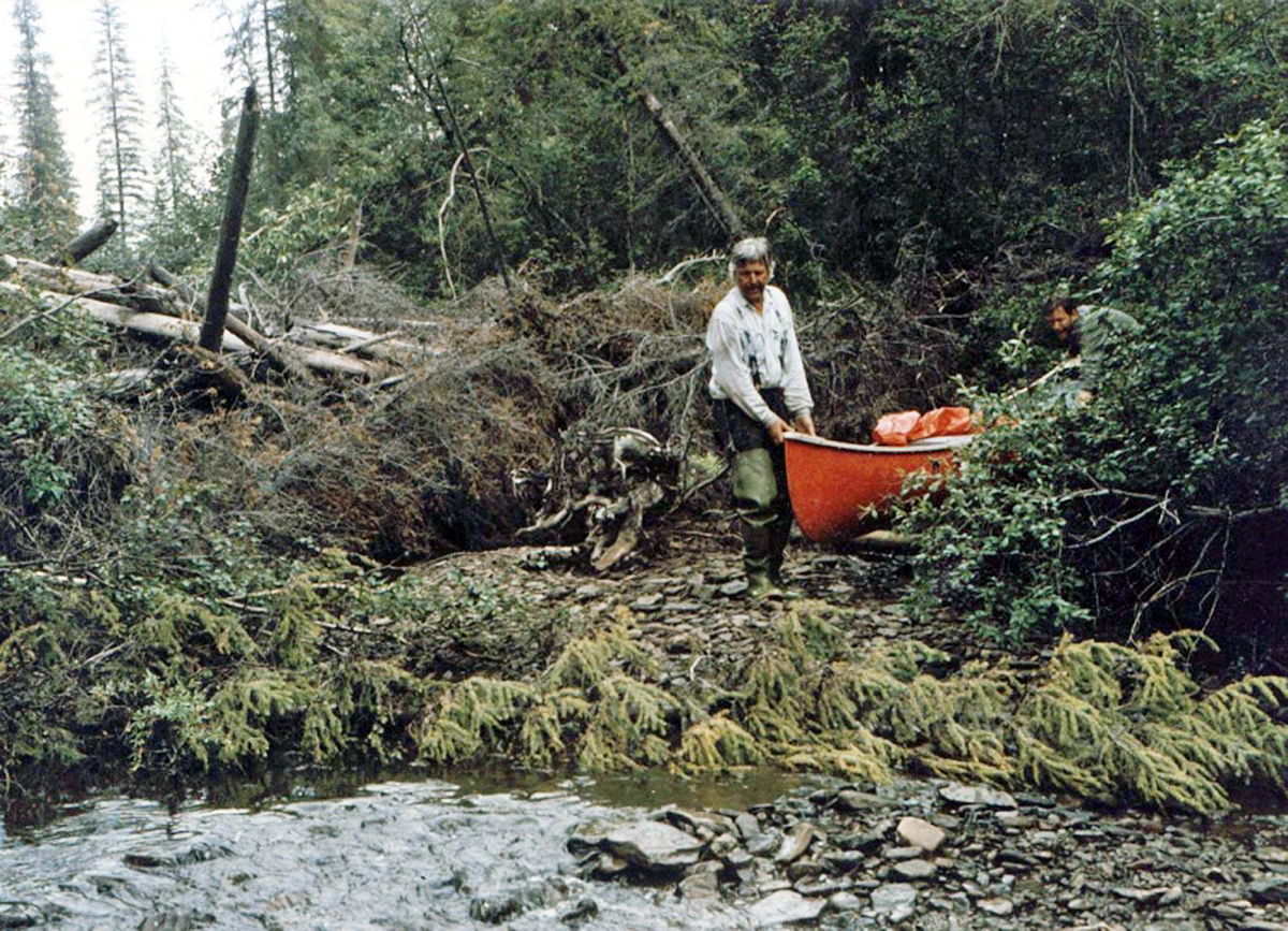
Beating through the bush
2nd stage
Instead of following the creek it is best now to cross it and march in a slanting direction to the second valley. After one kilometer you reach a cutline which runs through the whole valley and makes orientation so easy that it is no longer necessary to mark the route with little coloured hunter flags. Following this cutline till it crosses the creek you reach a point which is quite apt to act as a camping-place for the night.
3rd and 4th stages
The 3rd and the 4th day stages of your tour lead along the aisle to the end of the valley. However, this march was not at all easy because there was no beaten path. Numerous holes, marshy country and „niggerheads“ render the march difficult and involve the danger of breaking one’s leg. Yet, it is easier to follow the way described above than to walk along the right slope as we tried for one day.
Danny Hildebrand
5th and 6th stages
This aisle ends with the second valley, yet, there is a new one at right angels to Dempster. Before reaching the creek of the third valley you go towards the valley till the creek meets the steep slope. From that point on it is better to cover the following 3 km in the bed of the creek itself although it is very difficult with the creek having to little water for paddling at towing. Additionally, overturned trees block the creek, thus making navigation almost impossible. You can use the canoe as a means of transport for one quarter of the distance only; the other three quarters have to be walked. In spite of all these difficulties, this way is by far easier than the one through the bush; and there are also two fairly great sandbanks in the river-bed which offer two good camping-places.
The creek suddenly and quite astonishingly flows into another creek which runs through the fourth valley. Now it can nearly be regarded as a river because of the width of its bed. From now on you can go by canoe; only in some places is there the need to tow.
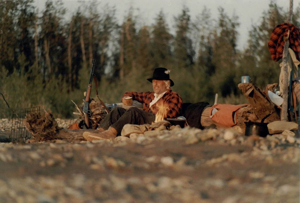
Camping on the river
Canoeing
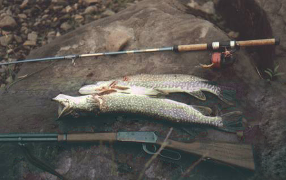
The wide creek makes paddling eventful as well as easy. Calm deep water changes to fast water in numerous small turns. There are no rapids, yet, you must take care of certain obstacles like trees or bushes (logjams) in the turns. Every now and then there are swells and back eddies. There are a variety of camping-places, the water is clear, containing a lot of fish, above all graylings, sometimes catfish and pike.
All the tributary creeks shown on the map were dried up during our tour; a few kilometres before the creek flows into the Whitestone River there are two tributary creeks (the one is coming from the right, the other immediately afterwards from the left side) which had enough water. Fishing was splendid there, too (grayling, she fish, pike).
More than enough Pike
After 50 km this creek flows into the Whitestone River which comes from the left side out of a wide valley. There is a back eddy, but it is not dangerous. Right where the two rivers join, there is a huge sand-bank on the left side offering good camping-places as well as good places for fishing (she-fish). From this point on you go along the Whitestone River for 120 km till the Miner River flows into it. The Whitestone also has clear as well as fast water. Its bottom is either sandy or covered with light pebbles. Again you won’t have to cope with rapids, yet, there are many narrow channels with swells in the turns, as well as obstacles like trunks or bushes you must take care of. Although there are a variety of fish. It is much easier to catch pike and catfish too(bottom fish). You can choose between a lot of camp sites; best are sand-banks which protect you from mosquito’s and unexpected appearances of bears.
The tributary creeks are difficult to find because they often flow into dead branches of the Whitestone River and have little water in midsummer. Whitestone Village no longer exists, just a few dilapidated log-houses can be found on the left side of the river a couple of meters above the site where the village once was. Shortly before the junction with the Miner River are a few islands so that the river, now being relatively wide, shows some channels, making the choice difficult with the low water-level.
As the Whitestone River and the Miner River rise in the Ogilvie Mountains, the Miner has clear water and heavy current which makes it appear more gigantic than the Whitestone which flows more sluggishly. At the junction there is a huge gravel-bank which is not good for camping because of its large pebbles. Yet, 3 km farther there is an ideal camping-place on the left side just before tjoining with the Cody Creek and there is the best possibility of catching graylings. The river then grows wider and wider and the velocity of flow steadily decreases. The water remains clear, but fishing is reduced to catching pike which can be found in great number.
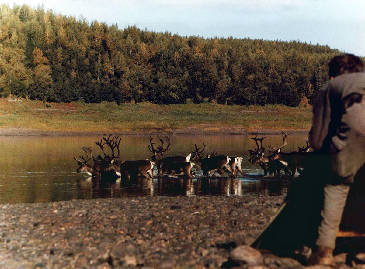
Caribou at the Bell River Mouth
The following part offers only a few good camping-places because sand-banks are lacking, the shore is muddy and the land is characterized by shrub and marshy meadows. Five miles above the junction with the Little Porcupine River there is an old Indian camp used by lumber-jacks from Old Crow with a comfortable hut. Further there are some cabins, but they are hardly seen from the river and often very desolate, that is they can’t even be recommended as make-shift beds. From the junction with the Bell River onwards the velocity of flow increases slightly but the clarity decreases because the Bell River brings a lot of sediment with it. Thus, there are various sand-banks which again offer better camping-places. There are even some camps and cabins partly used on the shore.
During late summer and autumn you can find a lot of caribou in the area between the confluence with the Bell River and Old Crow. There are not many difficulties when paddling along the whole Porcupine River. Even if the water-level is extremely low you can choose between many shallow channels running between a lot of sand-banks.
All the way down to Old Crow, one now and then encounters Indian inhabitants of the place who are out hunting and also occupy the occasional cabins on both sides of the river. In Old Crow you can easily be flown out by small propeller machines. The canoes, however, must remain on site….
 Modeling at the age of 76